Beyond Distance
PROJECT:
FOCUS:
ROLE:
YEAR:

THE OBSERVATION
A short route isn't always an easy route.
An independent UX exploration into how accessibility could become a first-class dimension of pedestrian navigation in Indian cities. Maps can accurately tell us how far a destination is, but distance doesn't tell us whether the journey is physically accessible.


THE INDIAN CONTEXT
The last 500 metres can change everything.
Station exit
Broken footpath
Missing curb ramp
Busy crossing
Destination

Parked vehicles
In Indian cities, pedestrian conditions can change dramatically within a few hundred metres.
THE PROBLEM
Distance ≠ Accessibility
An independent UX exploration into how accessibility could become a first-class dimension of pedestrian navigation in Indian cities. Maps can accurately tell us how far a destination is, but distance doesn't tell us whether the journey is physically accessible.


WHAT ALREADY EXISTS
Accessibility information already exists.
Google Maps already provides accessibility-related information for places and supported transit journeys. Existing accessibility concepts also explore better ways to surface this information.
WHAT NEXT
So I asked four questions.

01
What makes a pedestrian route accessible?
02
Which barriers actually change route choice?
03
How much accessibility information is useful?
04
How should accessibility influence routing decisions?
THE ACCESSIBILITY SYSTEM
Accessibility isn't one attribute. It's a system.
THE INSIGHT
Accessibility is a routing constraint, not a filter.
BASICS
Design principles.

ACCESSIBILITY PREFERENCES
Make accessibility part of route planning.
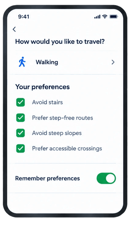
Accessibility becomes a reusable preference rather than a one-time filter.
Instead of an opaque "Accessibility: 82%" score, users can understand the evidence behind the recommendation.
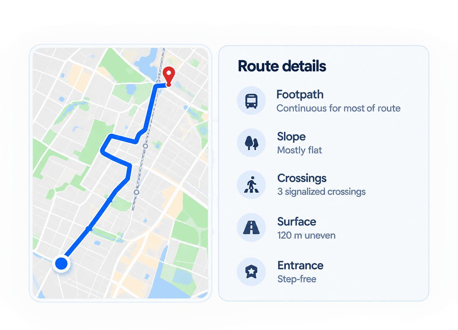
Surface relevant information only when it becomes useful.

ROUTE COMPARISON
Which route works for you?



The recommendation changes when accessibility becomes a routing contraint
Routes for you
Explain the route, don't just label it.
ROUTE IN DEPTH
NAVIGATION
Accessibility doesn't stop when navigation starts.
NAVIGATION
What happens when reality changes?

TRUST & SECURITY
Accessibility information needs a timestamp.
THE SYSTEM
From information to action
THE JOURNEY
Distance is only one dimension of a journey.
Can we make maps more aware of the people using them?

01
Preferences
02
Routes
03
Route Details
04
Navigation
Current route model
Destination
Distance
Time
Route

What the user actually experiences
Distance
Surface
Logo Design
Logo Design

PATH
Surface, Width,
Obstructions, Continuity.
CROSSING
Curb, Signal, Median
Crossing distance.
TERRAIN
Slope, stairs,
elevation.
TRANSIT
Lift, entrance,
platform.
DESTINATION
Step-free entrance, Lift
Accessible facilities

01
02
03
04
Make accessibility proactive
Don't make users discover barriers along the way.
Explain recommendations
Show why a route is recommended.
Represent conditions, not scores
Avoid reducing accessibility to a mysterious number.
Design for change
Accessibility conditions can change after the route is planned.